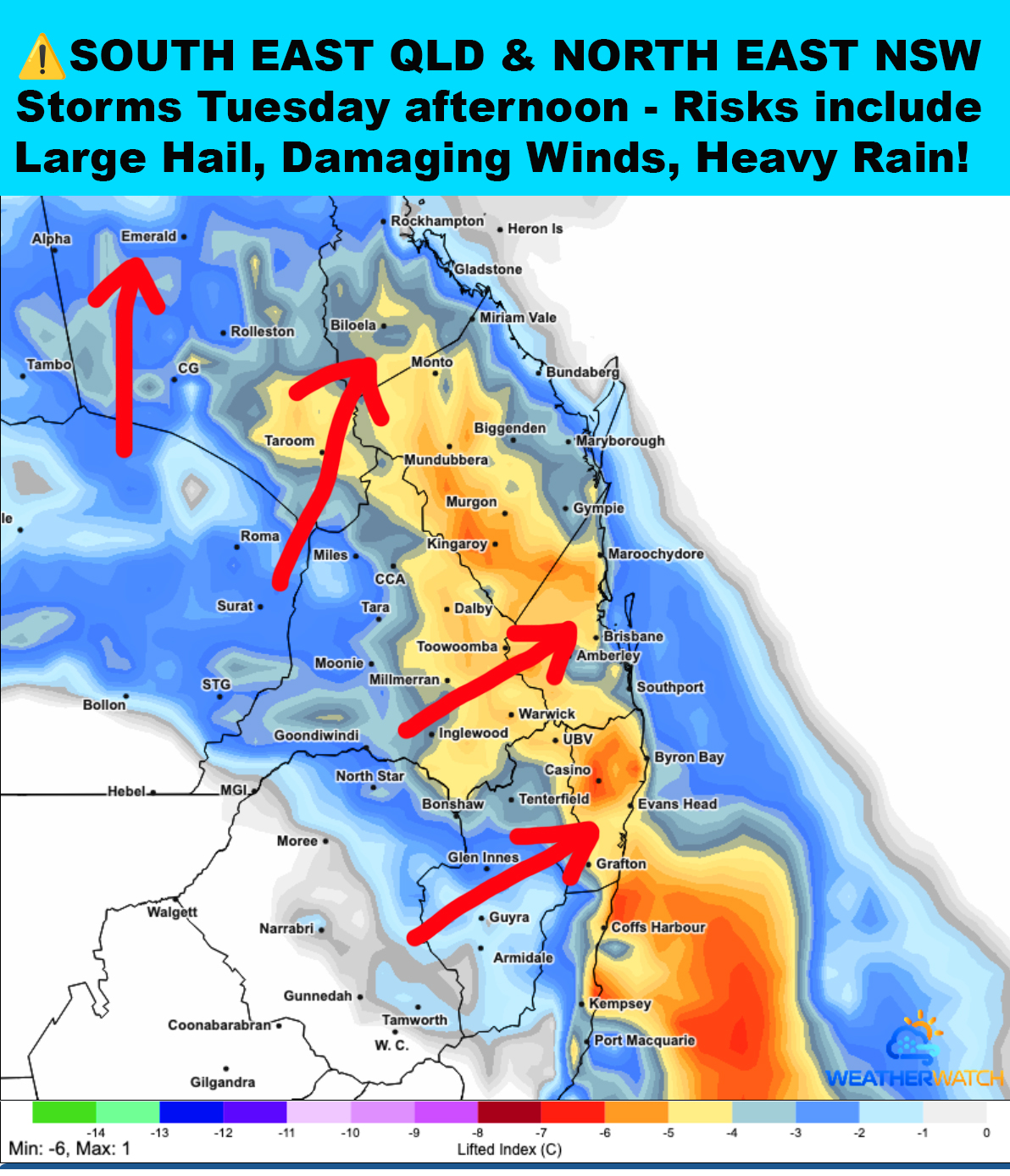
⚠️RIGHTIO, SEQLD & NENSW storm season is going to kick off properly this Tuesday - I dunno about you but I'd love a good thunderstorm with some decent rain! It's very dry out here...
👉A surface trough with good heating will be positioned through inland areas west of the ranges which will generate widespread instability. The airmass could be a bit drier inland so this may keep storms a bit more isolated...
👉Increased moisture levels across coastal areas and further north will cause storms to gain more intensity and coverage during the mid to late afternoon. Steering winds are strong out of the South West so cells will be moving quickly (red arrows).
⚠️🔴There is a high risk of severe storms occurring with large hail, damaging winds & frequent lightning - find out exactly where on our website and apps.
✅On our brand new website & mobile apps we have full forecast details which include our rain & storm maps showing where the highest risks will be! Also if a nasty storm is headed your way we send instant warning alerts to subscribers phones and email. Go here and have a look > higginsstormchasing.com/subscribe