Weather Forecast & Flood Risk
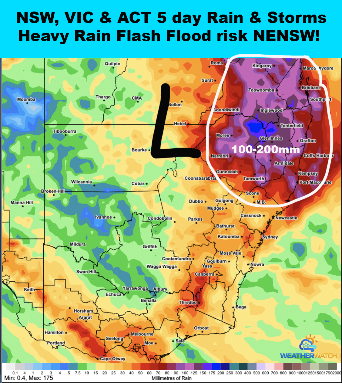
⚠️FLOOD WARNING ( HIGH RISK) issued for North East NSW from Wednesday 21st to Monday 26th of October 2026.
👉A dynamic weather pattern is forecast across North East NSW this week which is likely to lead to heavy rain areas causing flooding.
🔴Thunderstorms - some severe with heavy rainfall & flash flooding are likely for various locations within NENSW each day from Wednesday to Monday. A few very dangerous storms with extreme rainfall and life threatening flash flooding can't be ruled out. These storms may produce 75mm per hour rain rates with some extreme cells exceeding 100mm per hour.
🔴Rain bands with North South positioned stationary very heavy rain areas are also likely to develop with the highest risk areas both along the Coast and through inland areas. These rain bands may pose a high risk of flash flooding but could also generate some creek and river rises. The heavy rain bands may produce rain rates of 50-100mm per hour.
⚠️The highest risk of flash flooding is forecast across the Northern Rivers, Mid North Coast, Northern Tablelands and North West Slopes & Plains districts. Some moderate falls may entrained into the Hunter. Widespread falls of 100-200mm are likely with local higher falls of 250mm+ possible.
⚠️There is a risk of creek and river flooding but this will be issued individually as required and is highly depend on exactly where heaviest rain occurs.
✅The initial watch area has now be escalated to a warning area. Live weather updates and severe warnings will be issued when heavy rain and flooding develops.
✅Subscribers check the members portal for daily forecasts rain and storms maps and flood risk maps. Not a subscriber??? Join on our website for access!