Weather Forecast
At 8am Sunday some significant 2 day totals have occurred across the Northern Warrego region. Oakwood on the Ward River north of Charleville has recorded just over 200mm..
A strong trough remain anchored across the region which is likely to produce further rain areas with locally moderate falls possible.
Thunderstorms are likely each afternoon along the western dry line. Some of these storms could be severe with heavy rain, flash flooding, damaging winds and large hail. There have been numerous severe storms across western QLD over the past few days - especially the Central West.
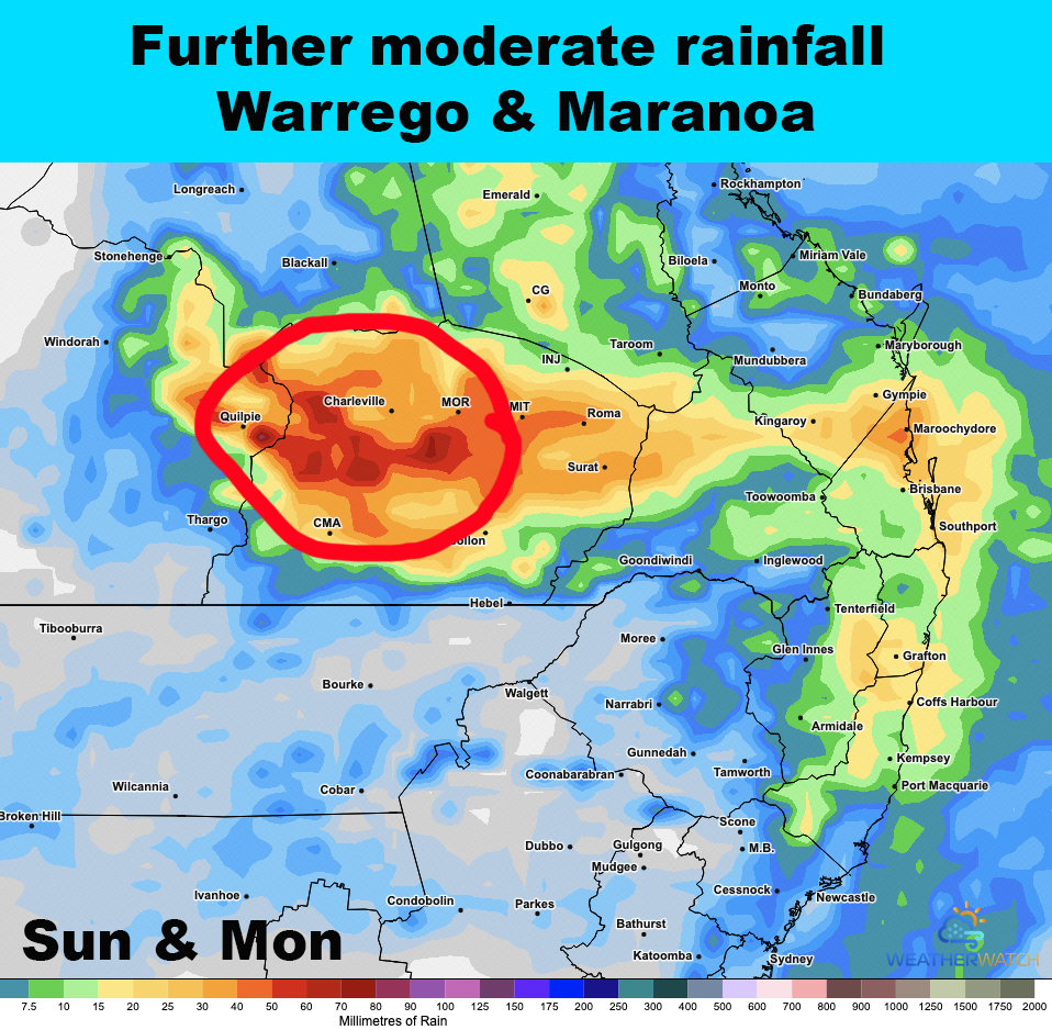
Rainfall totals of 25-50mm are likely across the Warrego during Sunday & Monday with locally higher totals to 100mm possible. The target area for these heavier falls remains just north of Charleville.
Some rivers and creeks have now started to run so could become more responsive to further rain.
More rain and storms are also forecast across the region during the week.