Weather Forecast
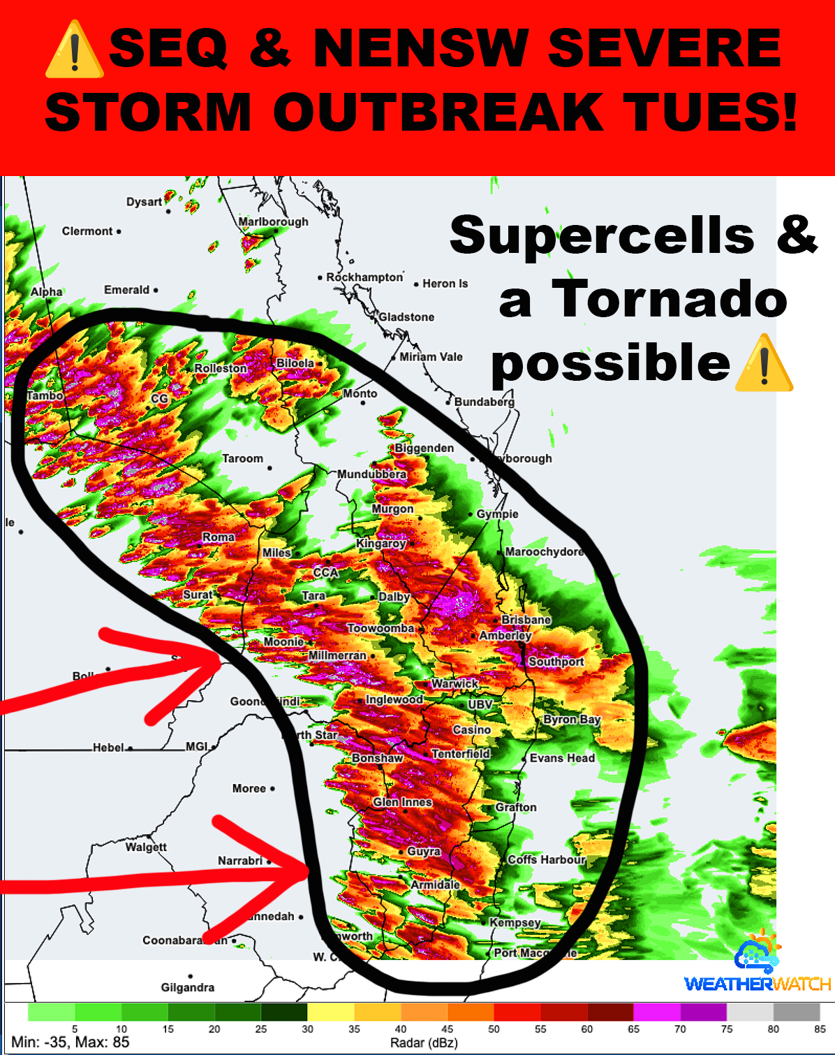
There are 2 ways for us to look at tomorrows forecast for SEQLD & NENSW and both have a very high risk of severe storms occurring! Some cells could go next level and be very dangerous - those ones you are in and go wholly F$%^
On the top end of the scale some High Precipitation Supercells are very likely to develop - I say HPS because the atmospheric profile is saturated with moisture and strong instability not to mention very fast wind shear. This combo generates extreme rainfall & flash flooding. Within that you also have the risk of microbursts with destructive winds over 125km/h and giant hail over 5cms up to around 10cms. These sups will be more discrete across both regions and picking an exact time and location is actually impossible - so it is more about the fact that they have reasonable potential of developing throughout the day.
A Tornado??? ONE OR TWO maybe - just leave it at that and see what happens. Like a needle in a haystack for those with a small but credible risk.
A severe storm outbreak is absolutely on the cards with heavy rain, flash flooding, large hail, damaging winds occurring anywhere in the circled area. I think we could see over 20 individual severe cells later becoming a Mesoscale Convective System (large cluster of severe storms).
You have been forewarned, so stay safe!
In North-East NSW & South-East QLD severe storms will amplify this Spring with Damaging Hail & Winds a very high risk! Do not delay getting your full access to our detailed forecasts, maps and instant mobile warnings - includes the free Higgins Weather app with member portal, advanced weather radar with weather layers… A true bargain package offering peace of mind at just over $1 a week! Go here to join higginsstormchasing.com/subscribe/