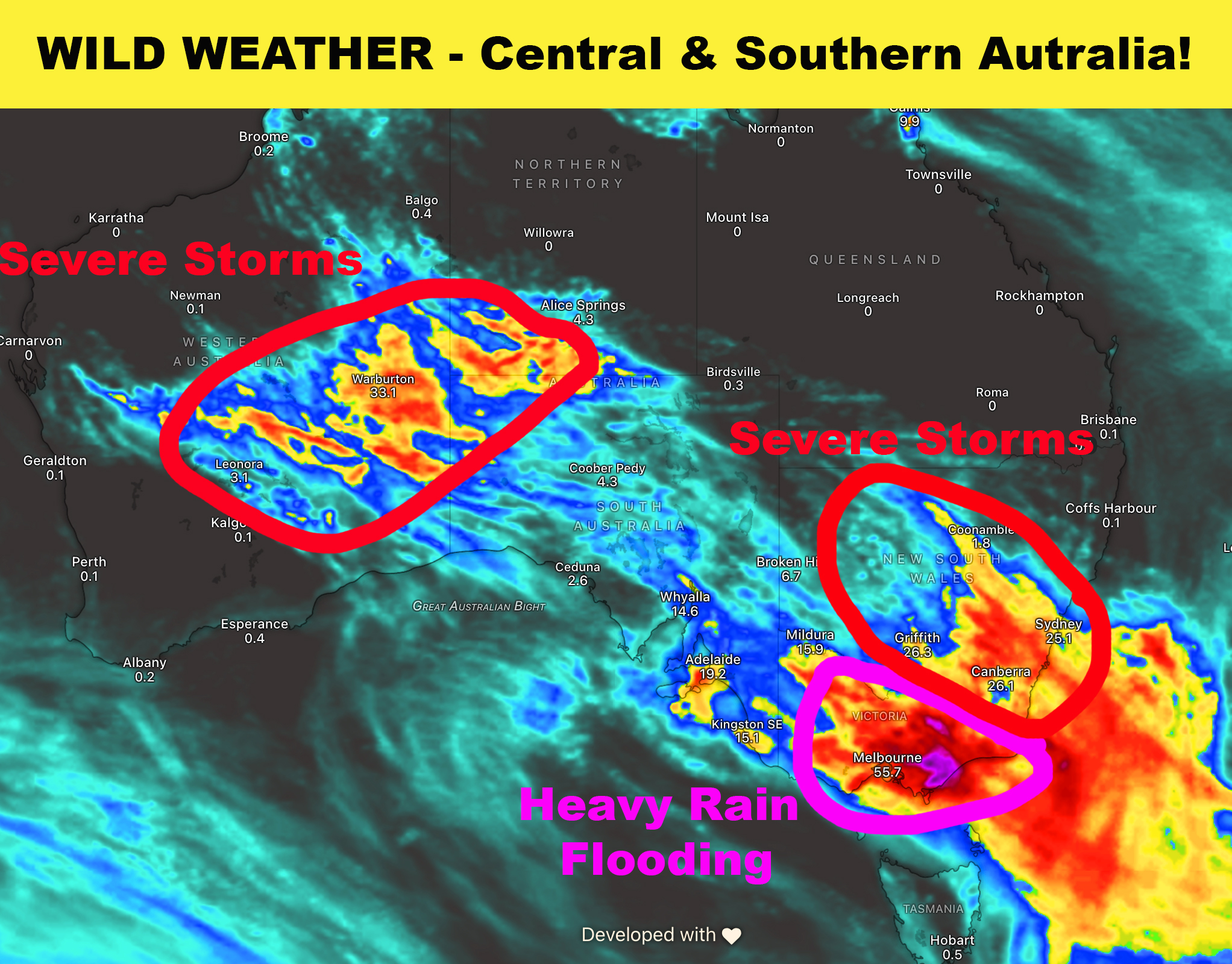
Weather Forecast Thursday - Sunday
🔴WA: A trough over the Southern interior will produce scattered storms today some likely severe with heavy rain, large hail and damaging winds. A low develops over Gascoyne & Southern Interior on Friday producing a stronger round of severe storms with heavy rain, large hail and damaging winds. The system moves east on Friday with a focus of severe storm activity across the Southern Interior for the third consecutive day.
🔴Uluru: Rain developing today with a possible storm tonight. Storms possible Friday afternoon / night. Rain Saturday with moderate falls and a possible storm.
🔴SA: A trough today will produce rain across the South East quarter of the state. Afternoon storms through inland areas with some possible severe with heavy rain, damaging winds and hail. Showers across the South East on Friday. Rain & storms across the North West Pastoral district on Saturday & Sunday.
🔴VIC: A trough will produce scattered showers, some rain areas and isolated storms across the state today. Heavy falls possible in Central areas this afternoon. A low develops along the NSW ./ VIC border on Friday. The system will produce widespread rain and storms across the state from Friday morning until Saturday night. Some storms possibly severe with heavy rain, strong winds and hail. Flash flooding is a high risk.
⚠️🔴From Friday afternoon through until early Sunday morning the low is expected to produce very heavy rainfall across the West & South Gippsland district. Rainfall totals up to 200mm are forecast across the district especially on the ranges. This heavy rainfall could lead to significant life threatening flash flooding and major flooding in these locations - Licola, Dargo, Heyfield, Rawson, Maffra, Sale, Traralgon, Lake Wellington and possible Bairnsdale. Closely monitor weather forecasts, warnings and conditions in these areas!
🔴NSW: Some showers and isolated storms along the NSW / VIC Border today. A front and low will produce a band of storms on Friday through Upper Western, Lower Western and Riverina districts. Some of these storms could be severe with heavy rain, damaging winds and large hail. Rain spreads into Central and South East NSW including the ACT. On Saturday the trough strengthens with a band of severe storms through the much of the interior of NSW in a band east from Bourke, Condobolin to Griffith and the ACT. These storms are likely to contain heavy rain, damaging winds and large hail. The storm activity moves east into the South East & Central NSW during the afternoon and evening - including Sydney.