Weather Forecast
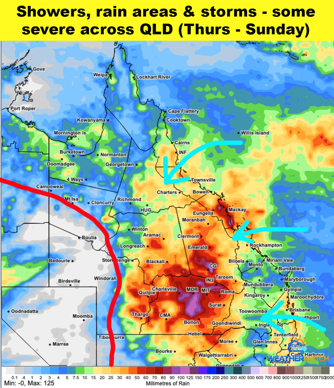
👉On Thursday a high in the Tasman Sea pushes a strong South Easterly wind change across SEQLD and up to CQLD. These winds feed increased moisture into a trough which runs from the Southern Gulf, northern inland, Central West to the South West / Southern inland areas. The wind convergence area along the coast is likely to cause showers and rain areas between Rockhampton & Mackay. A line of storms are expected to develop during the afternoon along the inland trough with some severe cells. The bands of storms move east during the evening and overnight but will not reach the coast.
👉During Friday the high pushes the wind change further north with showers between Mackay and Townsville. Deep moist onshore winds feeds into the inland trough which drifts west to Mt Isa to Windorah. Storms - some severe will develop during the afternoon right along this trough line through Western QLD. Into the evening and overnight rain areas and storms move slowly through the Central West and Southern inland areas.
👉For the weekend on both days deep onshore winds produce scattered showers between Rockhampton and Cairns with storms through the adjacent inland areas.
The trough will remain highly active with storms - some severe from Mt Isa, Longreach to Windorah and areas within 200kms east of this line. Each evening and night storms and thundery rain areas move east by remain well inland from the coast.
💦Overall widespread falls of 25-50mm are likely for Northern, Central and Southern inland areas. Isolated higher totals of 50-100mm are possible through Central & Southern inland areas. For the South East generally 5-15mm is possible.
✅Subscribers please check the members portal on our website and apps for full weather details with daily rainfall and storm risk maps. Live warnings and updates will be sent when required so be sure to have district level alerts turned on.
Website ➡️higginsstormchasing.com
App Stores ➡️Higgins Weather