Weather Forecast
The low level cloud across parts of the South East Coast & Darling Downs & Granite Belt early this morning will burn off. This will allow for maximum heating of 30C + very humid conditions leading to high instability levels from lunchtime onwards. A capping inversion is anticipated to restrict storm formation until the desired temperature and dew points are reached.
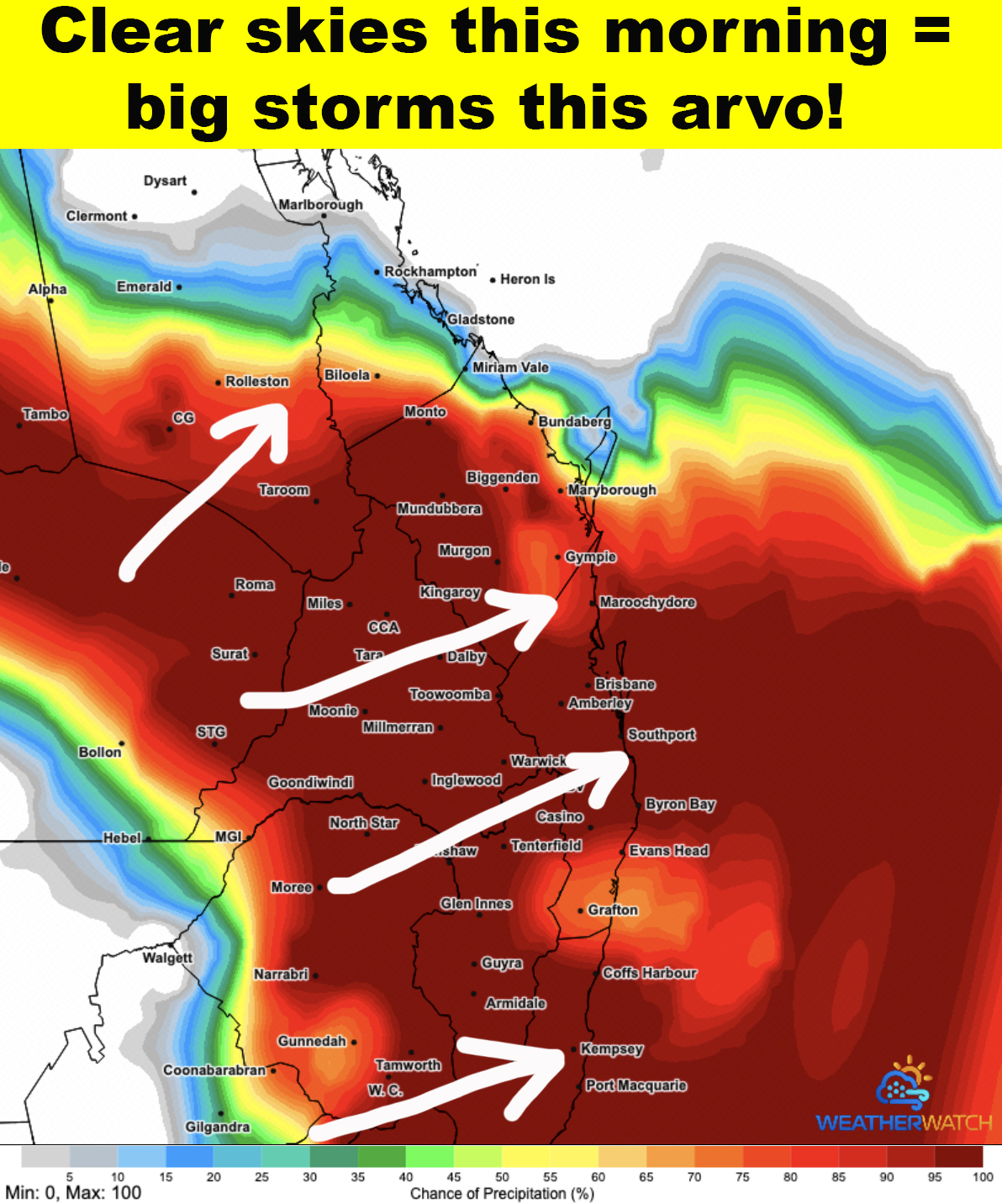
Wind data develops a surface trough along the ranges from Toowoomba, Warwick to Tenterfield which should act as an initial trigger for storm development. Cells along the ranges will rapidly intensify and track North East towards the coast during the afternoon.
Through inland areas west of the ranges the wind flow is initially tending more westerly however the surface trough retreats west into inland areas by late afternoon which aids storm development and intensification.
Overall scattered storms are expected across SEQLD & NENSW this afternoon and evening. Some cells are highly likely to become severe both along the coast and inland. All threats of large hail (possibly giant hail), damaging winds and heavy rainfall are a high risk within the strongest cells - NOTE that not every single persons house will get hit but areas in the red shaded areas are at risk!
Through inland areas some storms cells may split to become left and right movers due to linear wind shear. These have a risk of becoming Supercells (spinning meso storms). Evening and night storm activity is forecast for the Wide Bay Burnett district.
Stay safe people watch the sky and radar closely today - we will issue many warnings ahead of the storms! Tomorrow is shaping up to be way worse and we have growing concerns for Very Dangerous Cells forming causing damage!
Get our detailed forecasts, rain total maps, storm risk maps & instant severe warnings for heaps of locations right across QLD & NSW! Join the Higgins Premium Membership in less than 1 minute.