07 Jan Cirrostratus Clouds
[fusion_builder_container hundred_percent=”no” hundred_percent_height=”no” hundred_percent_height_scroll=”no” hundred_percent_height_center_content=”yes” equal_height_columns=”no” menu_anchor=”” hide_on_mobile=”small-visibility,medium-visibility,large-visibility” status=”published” publish_date=”” class=”” id=”” background_color=”” background_image=”” background_position=”center center” background_repeat=”no-repeat” fade=”no” background_parallax=”none” enable_mobile=”no” parallax_speed=”0.3″ video_mp4=”” video_webm=”” video_ogv=”” video_url=”” video_aspect_ratio=”16:9″ video_loop=”yes” video_mute=”yes” video_preview_image=”” border_color=”” border_style=”solid” margin_top=”” margin_bottom=”” padding_top=”” padding_right=”” padding_bottom=”” padding_left=”” type=”legacy”][fusion_builder_row][fusion_builder_column type=”1_1″ layout=”1_1″ spacing=”” center_content=”no” link=”” target=”_self” min_height=”” hide_on_mobile=”small-visibility,medium-visibility,large-visibility” class=”” id=”” background_color=”” background_image=”” background_image_id=”” background_position=”left top” background_repeat=”no-repeat” hover_type=”none” border_color=”” border_style=”solid” border_position=”all” border_radius=”” box_shadow=”no” dimension_box_shadow=”” box_shadow_blur=”0″ box_shadow_spread=”0″ box_shadow_color=”” box_shadow_style=”” padding_top=”” padding_right=”” padding_bottom=”” padding_left=”” margin_top=”” margin_bottom=”” animation_type=”” animation_direction=”left” animation_speed=”0.3″ animation_offset=”” last=”true” border_sizes_top=”0″ border_sizes_bottom=”0″ border_sizes_left=”0″ border_sizes_right=”0″ first=”true”][fusion_text columns=”” column_min_width=”” column_spacing=”” rule_style=”default” rule_size=”” rule_color=”” hide_on_mobile=”small-visibility,medium-visibility,large-visibility” class=”” id=””]
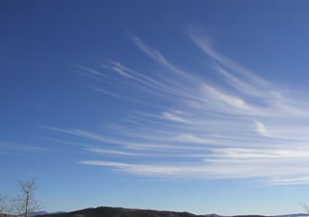
Cirrostratus clouds are high altitude clouds that are mostly transparent. They cover large areas of the sky which can sometimes lead to the formation of sun or moon halos (also known as a 22 degree halo). The appearance of a 22 degree halo may be the only indication that the clouds are even present due to how transparent and thin they become. The latin words cirrus and stratus mean lock or tuft and flattened / spread out which is exactly what these clouds look like – spread out locks of hair covering the sky.
Cirrostratus clouds typically sit no lower than 20,000ft in the atmosphere and can reach as high as 40,000ft. They from as a result of slowly rising air. They are usually generated at the forefront of frontal weather systems such as warm fronts and cold fronts and the movement of the clouds can be used to predict the weather over the next 24 hours. Cirrostratus clouds are also closely linked to vapour contrails as planes fly through the dry atmosphere.
While cirrostratus clouds don’t typically produce any weather themselves, they are fantastic indicators of approaching weather. There are 2 different forms or categories of cirrostratus clouds. (1) Cirrostratus Nebulous which likely indicates that an incoming front will likely produce persistent rain within 24 hours or (2) Cirrostratus Fibratus which likely indicates that stratus clouds may proceed it and produce precipitation (most likely in the form of light drizzle or rain). Cirrostratus clouds can span for thousands of kilometres and due to their transparent appearance, the sun is able to shine through them but at the same time, they can be slightly dense enough to still cast shadows on the Earth’s surface.
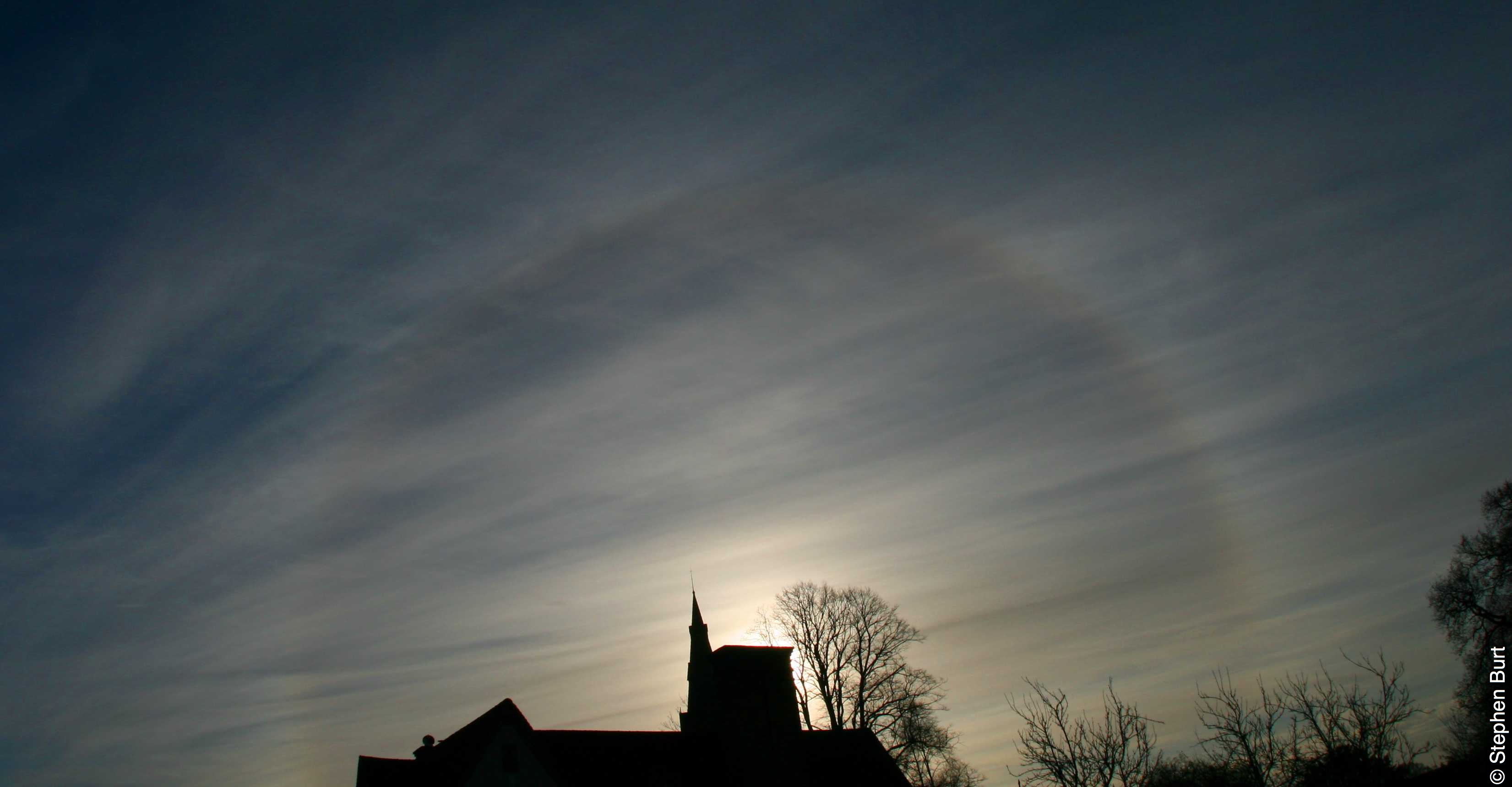
Cirrostratus Clouds with the sun reflecting through via Stephen Burt
[/fusion_text][/fusion_builder_column][/fusion_builder_row][/fusion_builder_container]
Sorry, the comment form is closed at this time.