20 Feb Public Forecast 20/02/25
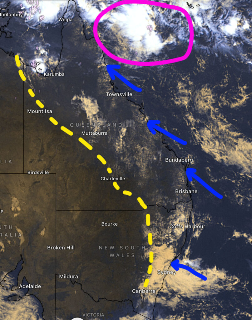
THURSDAY: A weak surface trough extends from the Gulf of Carpentaria through inland QLD and down into Eastern NSW (yellow line). Fine and sunny conditions are forecast to the west of this trough due to a dry airmass. Some showers and isolated storms are likely to develop this afternoon along and near to the east of the trough – A temperature inversion will prevent showers to storms through Central East NSW causing a cloud blanket. The most of the stronger activity is forecast across inland North East NSW where moisture and instability levels are slightly higher. There may be 1 or 2 cells that reach severe criteria along the ranges.
A few coastal showers are possible along the QLD coast due to moist onshore winds but any activity is expected to be light.
A weak tropical low is trying to develop in the Coral Sea off North QLD.
Subscribe to our premium for detailed rain & storms maps > https://higginsstormchasing.com/subscribe/


Sorry, the comment form is closed at this time.